Editor’s Note: These are the kind of posts that happen when you turn a history major loose in a museum. These posts were inspired by, and draw heavily on, an exhibit at the Montana Historical Society in Helena. Neither Empty Nor Unknown is an incredible exhibit that examines what life in Montana looked like during the time of Lewis and Clark. Follow the links to read Part 1 and Part 2.

When Lewis and Clark interacted and traded with plains peoples, they were actually taking part in a complex web of trade and cultures that stretched from Mexico to the Hudson Bay. In reality, the American West was already enmeshed in the interconnected Atlantic World, only a few degrees separated the nomadic people in Montana from the centers of empire in Europe. It would probably be overplaying my case to say that the complex web historians call the Atlantic World came to a head in Montana, but Montana does represent an interesting confluence of cultures. By the end of the 1500s, Spain had established itself in present-day Mexico, and began making incursions into the present-day United States Southwest by the early 1600s. The Spanish would trade mustangs and supplies, but not weapons, with the Indians. Historians believe that horses had entered the Montana area by the 1650s. The Shoshone were probably the first tribe in the area with horses, and became feared as warriors. To the north, the English and French were making inroads in Canada, and had no qualms trading guns for furs. At the center of this convergence were the Blackfeet. By being among the first to possess both guns and horses, the Blackfeet Confederacy became the most powerful group on the Northern Plains. Thus with guns from England and horses from Spain did the Blackfeet become the undisputed masters of their terrain until small pox took its toll in the 1830s. Of course there were many steps for supplies to make their way from factories in England to the Montana Plains, but my point is this: by the time of Lewis and Clark, Montana was already part of the global economy, if only on the very fringe.
When Lewis and Clark headed west, they entered a landscape with a complex history of human habitation, migration, culture, and land use. They thought that they were entering into a land of empty wilderness, but they were wrong. Aaron Parrett estimates that around 65,000 American Indians lived in present-day Montana during the 1830s, and it seems likely that the population was roughly the same in 1803. So Montana was sparsely populated, for sure, but it was populated. Just as it would be wrong to assert that Lewis and Clark discovered an empty land, it would be equally wrong to assert that the Expedition opened the area for trade. In fact, the Montanan Indians were already participating in the global economy by 1803.

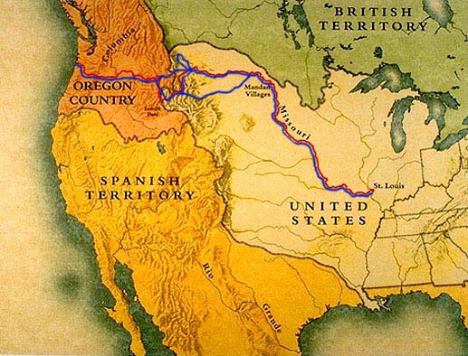
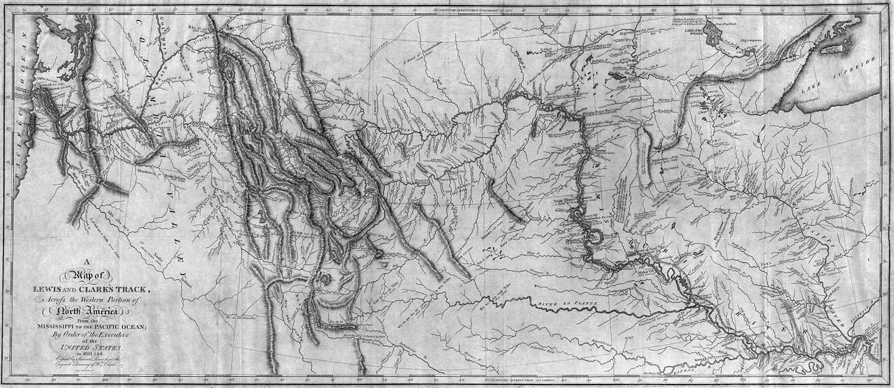
Ellen Baumler argues that the Expedition was essentially a seafaring mission. The expedition kept to the waterways, only rarely penetrating into the interior of the territory. The Expedition was very, very good at exploring and documenting the land they did see, but they never ventured very far from the Missouri. They were searching for a Northwest water passage across the country, they weren’t setting out to make a holistic survey of the region. The Indians, on the other hand, rarely travelled by water. They had the freedom to go where they wanted overland, so the Expedition missed them. In fairness, it would be easy to not notice 65,000 people in a place as vast as Montana. It is also possible that the Indians actively avoided encounters with the Expedition.

On the other hand, Lewis and Clark did encounter evidence of Indians in Montana. For example, Clark apparently followed a well-travelled Indian road, not a path or a trail but a road, near the Gates of the Mountains. Not much later, Lewis encountered what he took to be signal fires in the valley between present-day Helena and Three Forks. But they continued to believe that the land was largely empty. We know that it was not. We know that the Blackfeet, the Crow, the Gros Ventre, the Assiniboine and others called Montana home. Lewis and Clark made a mistake, but I think that we would be lying if we said that we wouldn’t make a similar mistake.
